This article may contain affiliate links, meaning we make a small commission on any purchases or bookings at no extra expense to you. For more info read our disclaimer & privacy policy here.
Looking for a stunning thru trail in the Dolomites? This 3-day, 2-night hut-to-hut hiking trail takes you from Palafavera to Cinque Torri.
Raf asked what I wanted to do for my birthday this year. I told him, “hike.” Since moving from Trieste to Belluno a few months ago, I haven’t been able to get enough of the surrounding mountains. Every chance I get I’m on a new trail. This time, I wanted to go farther than I had before and turn the lunches at the mountain huts into overnight stays. While there are plenty of great things to do in the Dolomites, hiking in the summer is an easy favorite.
Since he’s been dealing with some knee and back pains, he stayed home and I set off on my own, just using his services to drop me off in Palafavera and pick me up on the last day from Cinque Torri. Spoiled, I know.
Planning this trip just a week prior was a bit more challenging than I expected given the vast amount of trail and mountain hut, or rifugio, options in the region. It took me narrowing down my ending point and calling a handful of rifugi to see which had availability last minute. From there, I made my route and was ready to hit the trail.
I learned a lot from this first experience that’ll help me plan future hiking trips in the Dolomites, although I have to hand it to myself, this one was epic.
Here I’ll outline my route if you want to rinse and repeat but also share plenty of tips on how you can build your own adventure with confidence. While most people are drawn to the Alta Via 1, there are seriously 1000s of trails in these mountains, giving you all the freedom in the world to choose one less traveled.
Short on time? Here's the quick guide:
This 3-day hiking trip is a route I created for a weekend getaway. While you’re welcome to use my maps and do the exact same hike, know that the Dolomites is full of trails and mountain huts so you can plan your own adventure easily.
This trail will have you staying at:
Night #1: Rifugio Venezia
Night #2: Rifugio Croda da Lago
Lunch Stops: Rifugio Città di Fiume and Rifugio Scoiattoli
All in all, this route covers 21 miles / 33.5 kilometers over 3 days of hiking. The total elevation gain is 8,400 feet / 2,560 meters.
About us
We're Kat, from the US, & Raf, from Colombia. We've been traveling the world and living abroad for the past decade but now call Italy home.
Day 1: Rifugio Palafavera to Rifugio Venezia
Trail 472, with one of the helpful trail signs
6.2 miles / 10 kilometers
2560 feet / 777 meters gained
Trail 472
Palafavera is a small town on the other side of Mt. Civetta. It’s located nearby Val di Zoldo, which could also work as a starting point for this trail.
You can walk a direct path to Rifugio Venezia from Palafavera, or do what I did and take a slight detour to see fossilized dinosaur tracks. I enjoyed the detour but it did add on much of my elevation for the day.
This route is part of the “Anello Zoldano” that goes around Mt. Pelmo. While I didn’t complete the entire loop, I did about two-thirds of it between day 1 and day 2.
From Palafavera you have a slightly steep walk through the woods to get to the base of Mt. Pelmo. The terrain is heavily wooded and green. I saw two deer on the trail, which I always enjoy.
Once you get out of the woods, you’ll reach the intersection where you can either go right and head directly to Rifugio Venezia or go left for the detour to the dinosaur tracks (Orme dei Dinosauri). The detour only adds about 30 minutes to 1 hour on your trip but does get steep and rocky.
From this point, the walk to the rifugio is pretty flat. I saw a lot of people trail running here, which makes a lot of sense. You’ll have some nice views and see some pretty unique wildflowers but overall is a relatively peaceful day on the trail and a good warm-up to tomorrow’s challenge.
I made custom trails on AllTrails to keep me on route for this trip that I’m sharing here for you to use as well. The routes are correct but you will see the estimated distance is shorter than what I highlighted in the bullet-points. AllTrails has a tendency to do this so keep that in mind if using that app while planning.
Rifugio Venezia
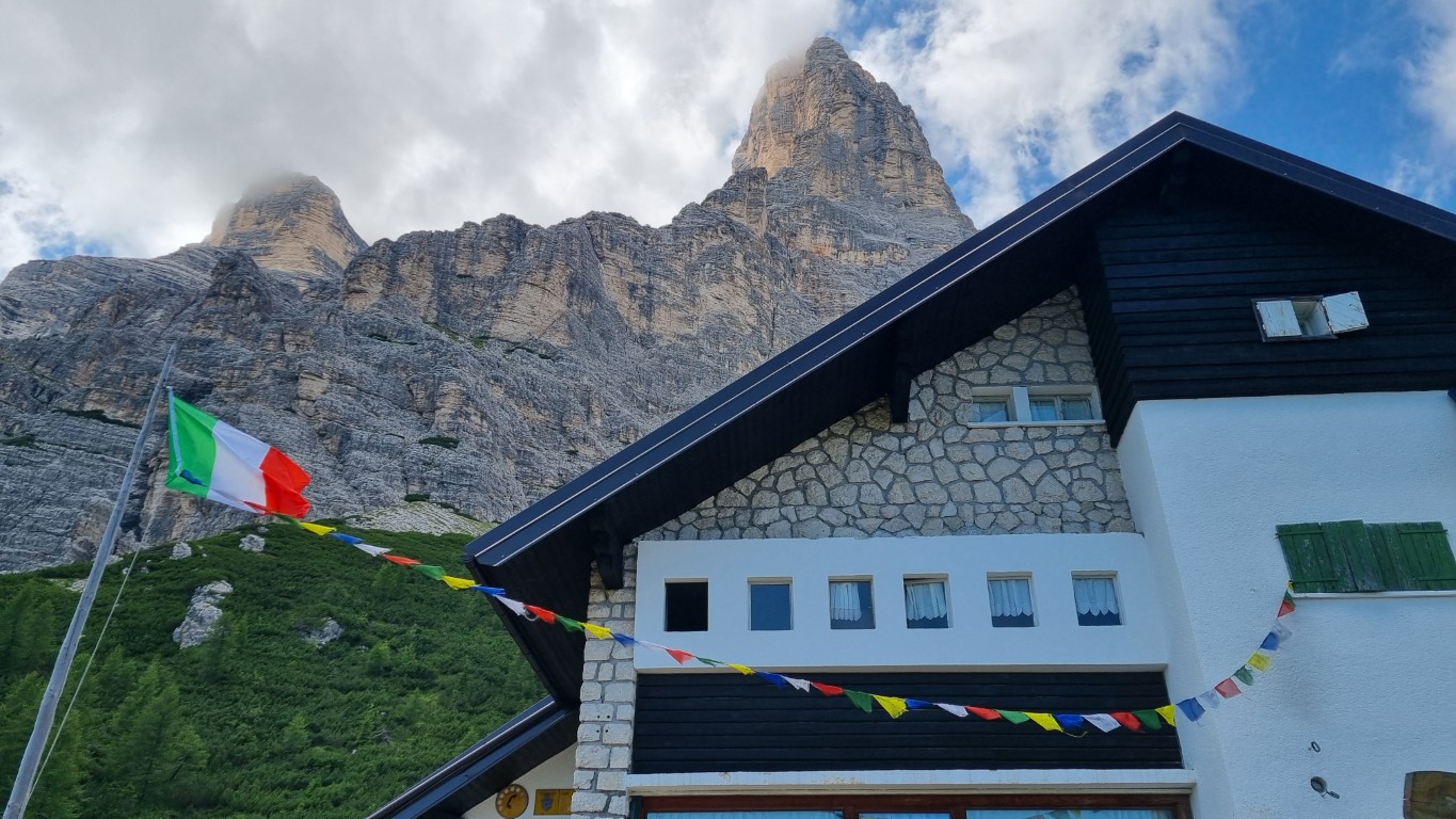
Rifugio Venezia at the base of Mt. Pelmo
I loved this rifugio. It’s small, nestled in a scenic location, and the food was really delicious. I arrived in time for a late lunch and in the evening filled up on the meal included with my stay.
Most rifugi will give you the option to just book a bed or to book a “half-board” stay. The half-board comes with dinner and breakfast and is something I’d recommend so you don’t have to carry your own food on the trails. From my experience, even though you're nestled up a mountain, Italians still care deeply about their cuisine and will serve you well.
While most rifugi only offer large dorm-style bedrooms, Rifugio Venezia has a few 2-bed rooms. I didn’t realize this when booking but ended up with my own room for my stay - a real treat in the mountains. I wouldn’t count on this as the norm but know that if you’re traveling with just one other person, there’s a chance you get a private room here.
Since this rifugio isn’t on the Alta Via 1, English isn’t as widely spoken. I was the only English-speaker for the night of my stay and I actually had to help the staff translate from Italian to English when a curious hiker showed up with loads of questions the next morning. Personally, this made me enjoy my stay more as I enjoy feeling like I’m in Italy when I am in fact in Italy but is something to keep in mind for those that don’t speak Italian. You’ll want to come with patience and Google Translate handy, if you have questions beyond the basic transaction.
Day 2: Rifugio Venezia to Rifugio Croda da Lago
The initial incline ascent of Trail 480
9.3 miles / 15 kilometers
3,635 feet / 1108 meters gained
Trail 480 (or 472) to Trail 467 to Trail 458 to Trail 436
Today is a long day and, I promise, not as confusing as the number of trails makes it out to be. Remember how I said there were 1000s of trails in the Dolomites? This just gives you a good example of how much freedom you have when building your itinerary.
An important note here is that you won’t see the name “Croda da Lago” on any signs, instead you’ll see “Palmieri.” This is the old name of the rifugio and one still showed on trail signs in the area.
There’s a big decision you have to make today about how you’ll leave Rifugio Venezia and head to Rifugio Città di Fiume, your half-way point of the day. You can either take:
Trail 480: This is a very challenging route and the one I chose
Trail 472: You’ll backtrack for the first half of the trail and have much easier day in terms of elevation
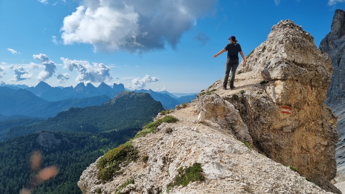
I really loved Trail 480 but it’s not for everyone. The elevation gain is tough but the decline is incredibly sharp - so much so that at one point you’ll use a ladder to go down. Since you’re crossing over part of Pelmo, the landscape is all loose rocks. You’ll want to take your time and be very sure-footed for this route.
If having to watch your every step for hours doesn’t sound fun, go back the way you came with route 472 instead. I also don’t recommend Trail 480 in bad weather - this one isn’t made for the rain.
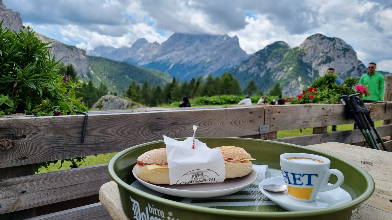
I suggest you stop for lunch and a break to rest at Rifugio Città di Fiume. You can either have an easy lunch outside with a quick panino from the bar or head inside for a sit-down meal with a menu. From Città di Fiume you’ll go to your ending point, Rifugio Croda da Lago (called Rifugio Palmieri on signs).
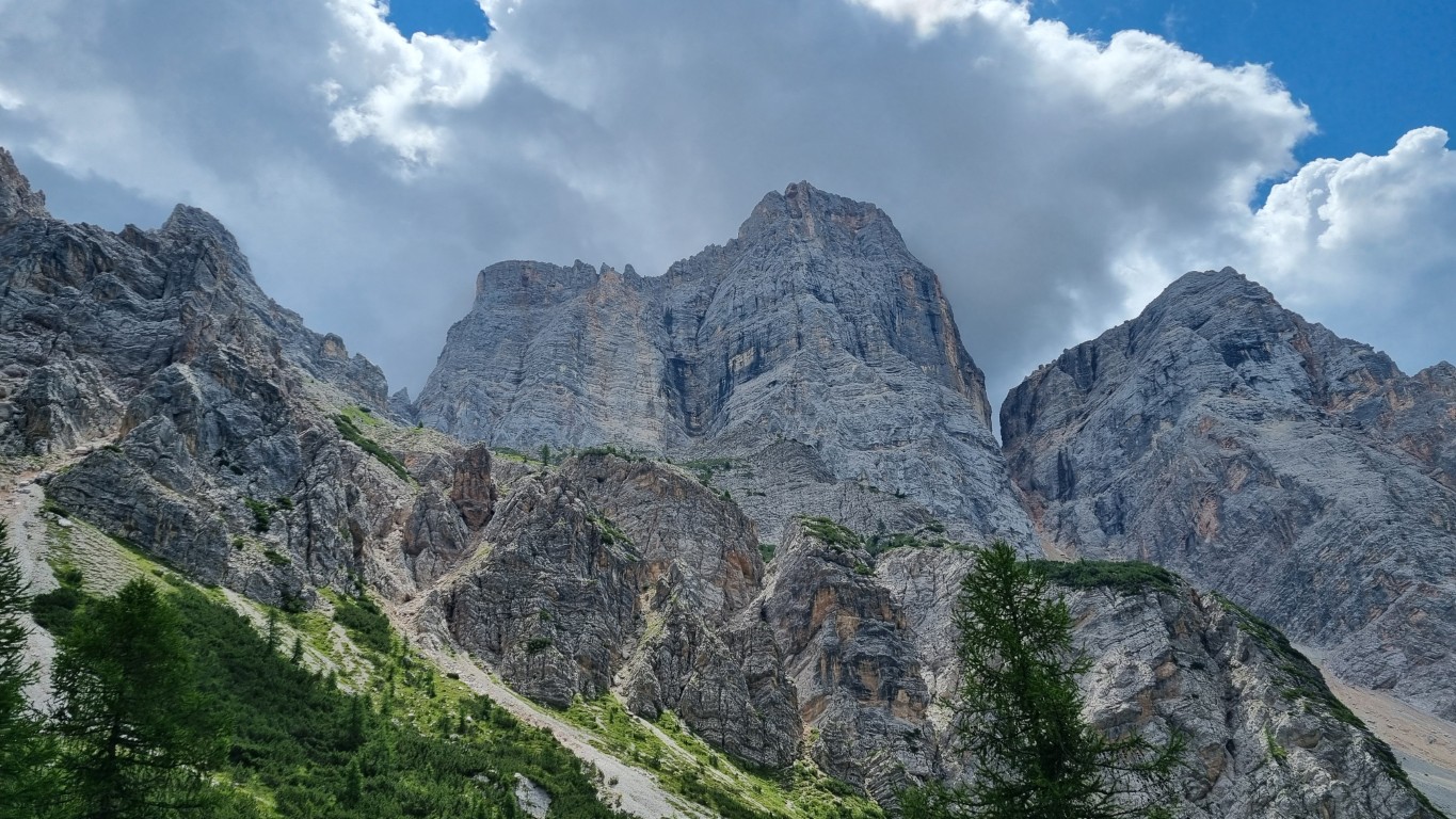
While you’ll technically walk on a few different trails to arrive, it’s easy since the name “Palmieri” is present at every intersection. The views from this section of the trail are truly spectacular. Be sure to look behind you at Mt. Pelmo every so often but ahead you’re always rewarded with jagged mountain peaks at strange angels.
Rifugio Croda da Lago
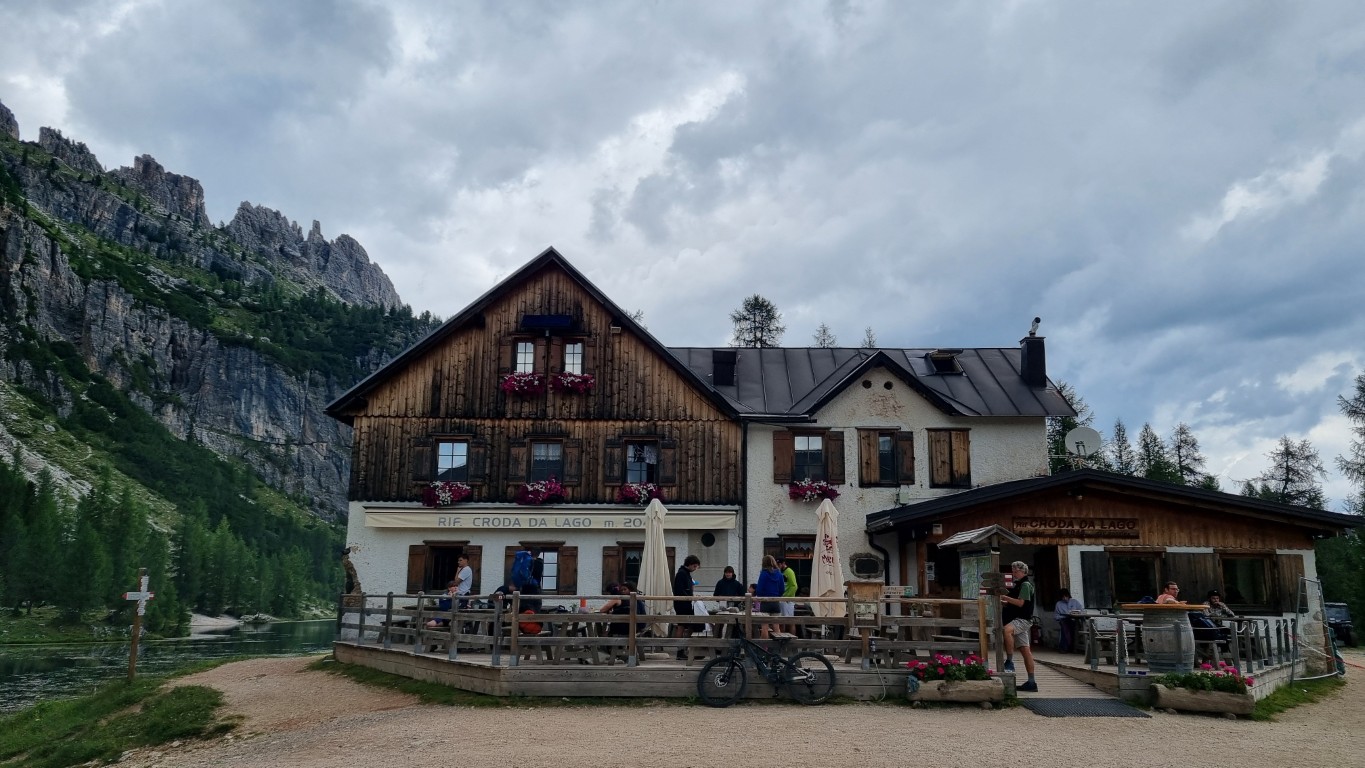
Rifugio Croda da Lago, just outside of Cortina d'Ampezzo
This mountain hut sits on a small lake backed by a steep rock face. The location itself is dreamy, just like everywhere in the Dolomites. It’s a bigger hut and located on the famous Alta Via 1.
If I were to redo this trip, I wouldn’t stay here again but I need to be clear why. The rifugio itself is clean, nice, and the food is good. The issue with it, for me personally, is that it’s on the Alta Via 1, making it a very crowded option and one mainly used by international tourists. In hindsight I’m actually pretty surprised I was able to get a last-minute reservation here.
I don’t plan to forever avoid the Alta Via 1 (the ending goes right by my apartment afterall and the trail to Rifugio 7 Alpino is one of my favorite day hikes) but I would avoid it for overnight stays. I enjoyed the tranquility of Rifugio Venezia more than the backpacker scene here. You however might prefer the exact opposite.
Day 3: Rifugio Croda da Lago to Cinque Torri
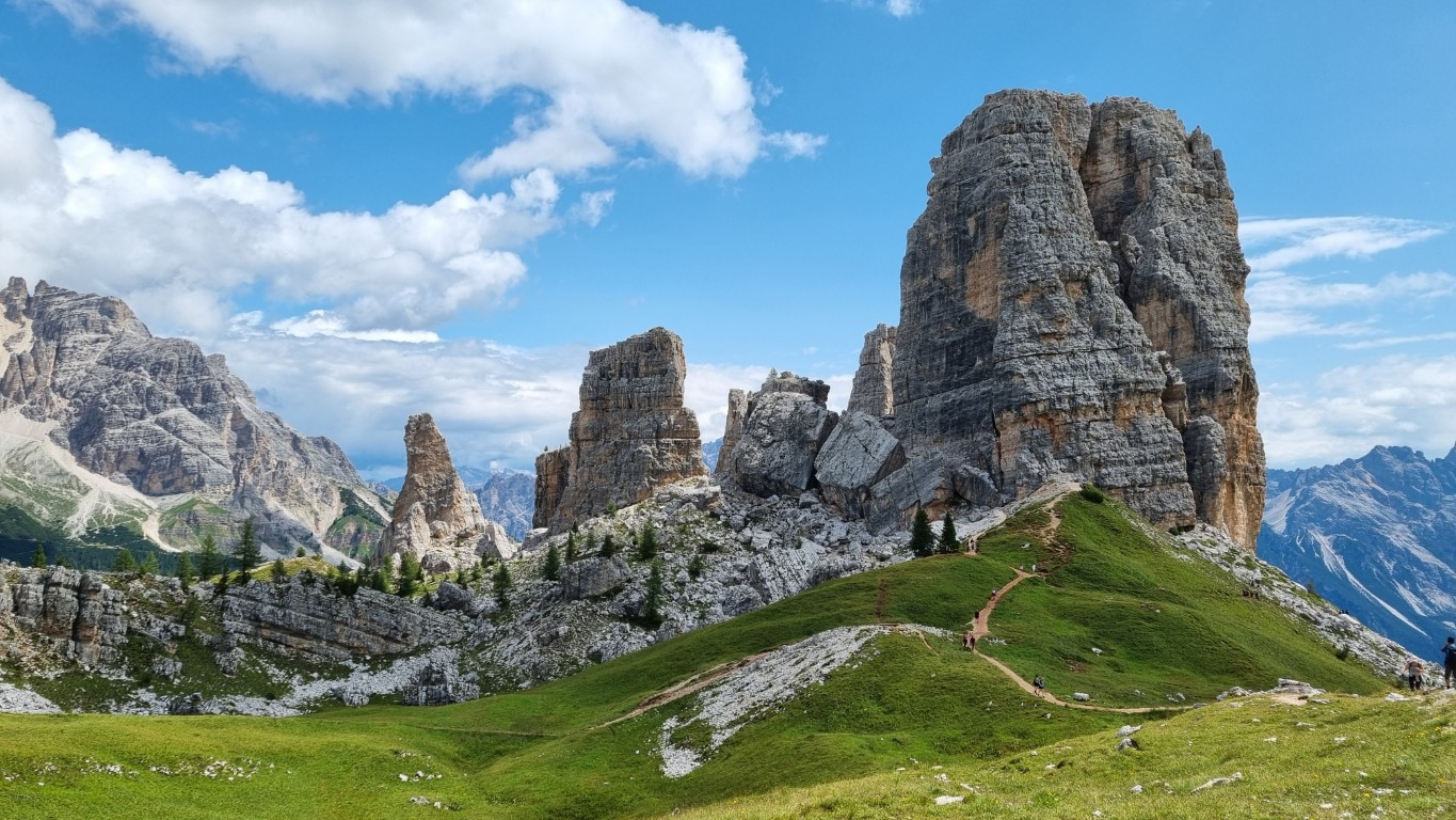
Majestic Cinque Torri is beautiful no matter the season
5.3 miles / 8.5 kilometers
2,200 feet / 670 meters gained
Trail 434 to Trail 437 to Trail 440
For a lot of today you’ll be in the woods, with small scenic viewpoints along the way. Just about 40 minutes into the trail you’ll get your first view of Cinque Torri (5 Towers) from across the way. To get there, you’ll walk down to a main road and then climb back up the mountain peaks.
This is part of the official Alta Via 1 trail and since it crosses over a highway with public parking, it was where I saw the most amount of people in my entire 3 days. Cinque Torri is also accessible by ski lift so don’t expect to have the views to yourself.
We chose this destination as my ending point and our meeting point for a few reasons: it's one of our favorite snowboarding spots in Italy and so we wanted to see it in the summer and since it’s accessible by ski lift, Raf didn’t have to put his back on a hike and could still enjoy a nice lunch in the mountains.
I highly recommend you take some time from up here to either do the full loop of Cinque Torri or at least sit in the grass for a bit and enjoy the scenery. As there are a few rifugi, you have some options for lunch. The one closest to the towers and main ski lift is Rifugio Scoiattoli. Here you can either have a quick lunch at the bar and eat outside or dine at their main restaurant. We’ve eaten at the bar in the winter but opted for the restaurant this time and it was delicious.
Just know, I’ve left the ending of this trail a little open ended for you based on where you need to get to after your hike. At Cinque Torri, there are a number of rifugi you can stay the night or, since there are 2 ski lifts and a larger gondola that connects near Cortina, you have some options on where to go from there. The easiest for more people would be to hike down to the gondola and head towards Cortina. From there, you could get a bus to the train station to leave the mountains. Otherwise, the other ski lifts might have buses that are more convenient. Google Maps is a good option to plan your public transportation route.
Helpful Hiking Tips in the Dolomites
A quick and easy lunch at Rifugio Città di Fiume
Even before we moved to the Dolomites, we’ve taken a number of trips to the region both in winter and in summer. I truly can’t get enough of the landscape and can confidently say, you’ll have a great time no matter the route you choose.
Best Time to Hike
The Dolomites get 4 true seasons: sometimes all in one day. Most mountain huts are only open from mid-June to mid-September but the exact location and elevation will slightly alter the dates. So, if you want to either stay the night or have lunch and coffee stops along the way, you’ll want to plan your trip around their season.
Regardless, I wouldn’t gear up for a spring or early summer hiking trip, especially if you plan to go into elevation. Even here in Belluno, our mountains were dusted with snow mid-May and we’re much lower than the peaks leading into the Alps.
Most likely you can enjoy an October hiking trip but it will depend on that year’s weather. Check the weather report and make sure your route didn’t get any heavy snowfall in the days leading up to your trip.
The safest bet is July and August and even then, hail and cold wind isn’t uncommon.
How Far Out to Plan Your Trip
Most things you’ll read will tell you to book your mountain huts about 6 months out. I booked my trip 1 week out.
There’s a key difference here that’ll help you decide when you should book. If you’re set on a very specific trail and mountain hut and aren’t willing to make any changes, book 6 months out. This will give you the confidence that you can stay exactly where you want to stay and be on the trail of your dreams.
If you’re like me and have some flexibility on where you stay and the exact route you take, this can be a last minute decision. I contacted 5 rifugi one week before my trip, 2 had availability and 1 contacted me a few days later about a cancellation and that 2 beds just opened up. For reference, I hiked over a weekend as well.
Hiking Gear
The biggest tip I can give you is to come prepared for all seasons but also to pack as light as possible - a bit of a conundrum, isn’t it?
You’ll certainly want to have a poncho or other rain gear, something to make sure your bag is also protected from the rain, and something clean to change into each night at the rifugio. I don’t often use hiking poles on day trips but was happy to have some on the steep declines and by day 3 when I was getting tired.
Don’t forget sunscreen, and ideally a hat to protect your face and a bandana to protect your neck. When the sun comes out here, it comes out strong.
All rifugi will also require you to have a sleeping bag liner to use on the bed. I also brought a quick dry towel that I was thankful for after my nightly shower. Since you’ll likely be sharing a room with plenty of others, bring ear plugs and an eye mask.
Dolomites Terrian
The terrain in the mountains changes often. At lower elevation, you’ll likely be in densely wooded areas, with a soft wet ground and plenty of tree roots to walk around.
As you gain elevation, the terrain gets rocky. Towards the tops of any peaks, this rocky terrain gets loose and has a lot of scree.
The trails in between that wind through the farms tend to be either gravel or in some parts paved for farm vehicles to get around. Here you’ll also come across plenty of dirt trails that can get pretty muddy in areas.
Essentially, if you go on a long trail that covers a range in elevation you can expect a variety of terrain. Hiking boots with ankle support will be essential unless you’re an experienced trail runner.
Planning Your Route
Planning your own hiking route can feel intimidating but I promise it’s possible. If you’re like me and prefer quieter trails and don’t need to see the most famous landscapes or walk on the iconic trails, you’re in for a treat.
Since there are so many options, I recommend you choose one thing you just have to do - this could be your starting point, ending point, or a scenic spot in the middle. This will give you an anchor and make your initial planning a lot easier. Using that anchor, start looking for rifugi nearby. Once you have one, decide how far you’d like to walk between days and start looking for a bed in your second spot.
Some rifugi require a deposit so if they do, I’d wait to pay until you have your entire route planned out. If they don’t require a deposit, you can go ahead and book one while you look for the next stay, knowing you can always cancel if needed.
I’d use Google Maps to find the rifugi (just zoom into an area and type in “rifugio” to see what’s around) and then AllTrails to make your custom routes. You can pick a map that’s already created and customize it easily on the free version of the app. Using the desktop version makes this incredibly simple. Just keep in mind the final distance might be longer than the app shows but the route itself will be accurate.
How to Arrive to the Dolomites
Traveling by public transportation in Italy is usually pretty straight forward, that is, until you get to the mountains. There are a few train options to start your journey:
Belluno
Bolzano
Cortina d’Ampezzo (via the Cortina Express)
That’s it. To get closer to the trail heads you’ll need to rely on a bus, taxi, or a rental car. If you choose to rent a car, I’d suggest making your hiking itinerary a loop so you don’t have to worry about getting back to your car after your trip.
Alleghe has a big underground parking deck that you could leave your car in. From Alleghe, there are a number of trails and even a gondola to get into the mountains.
Generally, Google Maps does a really good job here outlining the public transportation options and bus schedules if you decide not to rent a car.
You’re Ready for Your 3-Day Hike
Mt. Pelmo is a looker from all angels
Whether you hop on the trail route I created or build your own, you’re in for a real treat. The rifugio culture combined with the stunning views of the Dolomites makes for a hiking trip any outdoorsy person can enjoy.
Just know, you don’t have to be on the same route as everyone else to enjoy yourself. There’s enough scenic views in this region to spread out and have your own fun.
Travel Italy like you live here
Get Italian travel tips straight to your inbox + 2 bonus freebies right away.
By clicking “Accept All”, you agree to the storing of cookies on your device to enhance site navigation, analyze site usage and assist in our marketing efforts as outlined in our cookie policy.